Devon · EX36
Drone search and rescue cover in South Molton
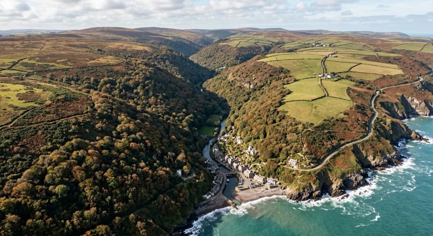
Aerial search cover across the hedge-bound farmland and moor edge around South Molton, on Exmoor's wet southern approach.
Farmland that runs straight onto the moor
South Molton sits on rising ground between the River Mole and the River Bray, on the southern approach to Exmoor, and the farmland around it is the kind of open, working countryside where the most common call is not a missing walker but a missing animal, sheep or cattle strayed off their ground, or a farmer needing a large area checked quickly before stock gets onto a road or into trouble. It is also where the town's edge meets properly open moorland country, so a missing person here can just as easily be heading up onto Exmoor as staying on farmland closer to town.
Livestock farmland is deceptively hard to search on foot because it is broken up into small fields by hedge banks, and those hedges, along with dips, streams and patches of rush, hide a surprising amount of ground from someone walking the boundary. Checking a run of fields properly means walking every one of them, not just looking over the gate, and on a working farm that can mean a lot of ground and not much daylight to cover it in.
Seeing what a hedge line hides
From the air the same fields read completely differently. A drone can run the length of a farm's fields in a fraction of the time a foot search takes, checking hedge lines, ditches, and the low, wet ground where stock tend to gather or a person is more likely to be sheltering. The thermal camera is particularly useful on livestock work, because sheep and cattle show up clearly against cooler grass, and the same is true for a person who has gone to ground out of the wind against a hedge or bank.
This is also some of the wettest ground in Devon; Exmoor to the north keeps the weather coming, with high rainfall and long spells where the ground barely dries out between one front and the next. Wet, waterlogged fields are harder and slower to walk than dry ones, which makes an aerial check more useful here than in a drier part of the county, and this open, exposed ground takes sustained wind loading in weather that would keep a search team walking for hours to cover what a flight covers in minutes.
A working market town as the starting point
South Molton itself, with its Pannier Market at the centre and the approach road up onto Exmoor National Park running out the other side, is a good starting point for briefing a search that might range anywhere from town gardens to open moor edge. Reference points like the River Mole, Quince Honey Farm and the Exmoor approach itself help a search coordinator or a family talk about ground they already know, rather than working from a map alone.
A search here often starts as a farm job, checking fields and boundaries for stock, and can widen quickly if it turns out a person is involved instead, or as well. Because both cameras are already set up for open, mixed farmland, moving from a livestock check to a wider search over the same ground does not mean starting again with different equipment, just widening the flight plan to cover more of it.
Behind the flight
What sits behind a search around South Molton
CAA registered
Operator ID and Flyer ID held, plus the A2 Certificate of Competency. Paperwork is available on the phone before a flight, including to the police or a search coordinator if it is needed.
Radiometric thermal
A DJI Mavic 2 Enterprise Advanced carrying a 640 by 512 thermal camera, strongest at dawn, dusk and after dark, which is when a ground search slows down the most.
100 megapixel visual camera
A DJI Mavic 4 Pro with a Hasselblad camera and 6K video, used for daylight coverage and for legible imagery of anything found, close enough to act on.
Insured with Coverdrone
Full commercial cover for the operation. Certificates go to a search coordinator, a landowner or an event organiser as a matter of course, without anyone having to chase for them.
Nearby
Also covered around South Molton
- BarnstapleAerial search cover for the tidal Taw around Barnstaple, from exposed estuary mudflats to wooded slopes climbing towards Exmoor.
- IlfracombeAerial search cover for Ilfracombe's cliffs, coast path and harbour, where steep ground and Atlantic wind slow a search on foot.
- MineheadAerial search cover from the steep bracken slopes behind Minehead down to its harbour, on Exmoor's northern edge above the Bristol Channel.
See how a search is flown
Call now, same day in South Molton
Call with the location and what has happened. Sam Hembury will come back with a fixed price and get airborne as soon as it is safe to.